ImagePlot visualization software: explore patterns in large image collections.
ImagePlot is a free software tool that visualizes collections of images and video of any size. It is implemented as a macro which works with the open source image processing program ImageJ.
Join us as we get a behind-the-scenes look at the inner workings of five influential Bay Area design studios during our Fall / Winter Studio Tours. See projects in progress, learn about different firms’ cultures and methodologies, and rub elbows with design luminaries and up-and-comings in the environment that inspires their best work.
iYou [iyou.nu] is an almost-working proof-of-concept developed by Mind Design that visualizes the still relatively unexposed usage data of a typical iPhone, such as historical phone call activity, text message contents, or Facebook communication patterns.
The big news from the US Department of Agriculture, of course, is their move away from the familiar and iconic food pyramid and into their new plate-based system of showing us how much of each type of food thing we should be consuming (full disclosure: this writer’s wife works somewhat directly with the group that creates these pyramid and plate guidelines for the USDA and certainly wouldn’t appreciate his use of “food thing” to describe types of food). And with the transition from pointy to round, eventually the media was going to have to turn to a design expert. We were both surprised and pleased as punch that CBS Evening News went directly to Pentagram‘s Michael Bierut and Mine's Christopher Simmons for their commentary. It’s the nightly news, so of course he only gets a few words in, but nice to hear from someone outside of the food world or government sharing their insight. Here’s the clip:
The demand for interactivity has reshaped every aspect of our culture. No longer content to simply observe and absorb, we expect to shape our environment and personalize our experience. Held at San Francisco’s beautiful new McLoughlin Gallery, this salon will explore how cities, neighborhoods and cultural organizations are using interactive media to engage people in public spaces and create a sense of place. Join our eclectic panel as they show innovations from around the globe and hypothesize where this trend is going. Debate encouraged!
... helping cities, neighborhoods and organizations understand the identity or "story" of a place and bring it to life through innovative art and design...
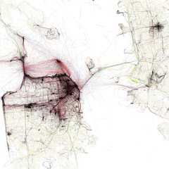
The GIS Education Center and CCA URBANlab are hosting a free lecture with Google, GreenInfo, and Stamen this upcoming Thursday, Nov. 4th 6-8pm at CCA, to discuss data visualization and mapping. This is a great opportunity for students to learn and understand the process of raw data to visual print and web development for Google Geo, Stamen Design, and GreenInfo.